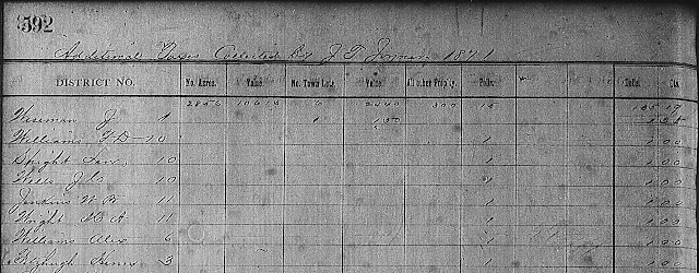
After viewing the tax records, I ordered the next deed
books that I felt I needed to read through in order to find the remaining
neighbors’ land. Last Saturday, I went
to my local Family
History Center
to view them. Unfortunately, I didn’t
find any of the neighbors I’m still looking for. There were deeds of interest to me in them
for the particular area, but just didn’t happen to be for my ancestor’s
neighbors.
I looked through all of vol. R and began reading through
vol. Q. Since the microfilm scanner was
being used by another patron, I put off scanning what documents I found and
resolved to scan them at a later date.
Once I returned home, I decided since I was almost finished
reading through vol. Q that I would order another roll of microfilm and that’s
when I made an amazing discovery.
Apparently, FamilySearch.org has digitized some of the deed books I’m
interested in reading through available online.
Still many of these records haven’t yet been digitized, but because many
that I’m interested in reading through are, I won’t have to order them and can
view them from the comfort of my living room.
Since vols. Q and R were available digitally, I was able to
download the images I had noted down while at my local Family History
Center. Then I took up where I left off in vol. Q and
downloaded what images pertained to the area I’m researching.
 |
| Portion of digitized deed book |
The schedule for this coming Saturday is to look through the
rest of vol. Q and download any that are pertinent to my research. Then if I have time, enter them into
DeedMapper.
I searched through more of FamilySearch’s land records
holdings for Hardeman County,
Tennessee and found that survey
books, one roll of petition records, and an early roll of tax records have all
been digitized so they’re available online.
What helped me was the fact that the deed index for Hardeman County, Tennessee
has been digitized. Yes, just because
it’s an index I know that it’s not inclusive of every deed or document that was
ever recorded in Hardeman
County. But still, it’s a place to start in locating
the remaining neighbors’ deeds or review to see if I missed something.
After noticing this interesting bit, I looked through the
1860 census and noted on my neighbor list those who had been enumerated in
Civil District 12. This information
should help me determine when someone may have purchased their land in my
ancestor’s neighborhood. The only
obstacle with the land records in Hardeman
County is that tax
records and deeds during the years around the Civil War are not extant. So there is the possibility that if some of
John Washington Womble’s neighbors bought land during that time period that the
document may not have survived the war.
There’s also the possibility that the deed could’ve been recorded much
later.
The search continues…


